
WeMap
Crowdsourced map based mobile application for enhanced accessibility
WeMap aims to be a dynamic co-construction platform that offers the necessary information on the “spatial heritage” according to the degree and difficulty of physical mobility. A heritage that will evolve over time according to the criteria of the individuals or according to external factors.
The weakening of health has consequences on the loss of autonomy and in particular on the ability to travel independently and safely from one’s home to the chosen destination. At present, people with reduced mobility are unable to obtain accurate information about their travel routes and obstacles between the starting point and the chosen destination. For many, this uncertainty causes significant stress and even the simple decision not to travel can result in social isolation and loneliness, impacting on health and quality of life. Mobility is therefore an essential factor in promoting health and quality of life among people with “social fragility”.
Each person’s life course is confronted with unpredictable events that modify their physical and cognitive capacities and their ability to move around in private (house, flat, residence, etc.) and public environments. As individuals, we manage a “mobility/locomotion heritage” defined in the dimensions of time, space and physiological capacities. This mobility asset evolves throughout our lives according to our physiological needs and capacities (intrinsic factors) but also the constraints imposed by our ecosystem (extrinsic factors). Currently, there is no digital application that allows for detailed planning of a trip from home to a specific location (door-to-door concept), documenting the obstacles for people who use a wheelchair or an assistive device.
WeMap is a concrete proposal to inform the person with a disability about his or her route and its obstacles, thus promoting autonomy in mobility and preventing falls or immobilisation on the public highway. It aims to increase autonomy and ensure the safety of travel by preventing a number of incidents on the public highway, and thus avoiding health costs (decision making). This application will indirectly, through the information it contains, support the political decision-maker in his or her land-use planning choices (policy making).
Partners: HES-SO Valais-Wallis, La Poste Suisse
Funded by: HES-SO (2016-2017)
For more information: Nicole Glassey Balet nicole.glassey@hevs.ch, HES-SO Valais-Wallis


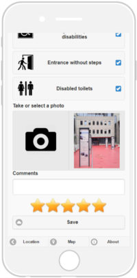


User interfaces for mobile applications :
- (a) search for points of interest with a specific address,
- (b) addition of a new point of interest or street situation,
- (c) revision of an existing point of interest,
- (d) route service form,
- (e) generation and display of route services.
Downloads
Download “When Smart comes tu Town: A mobile Platform for Smart District Services”
Download “Crowdsourcing-based mobile Application for Wheelchair Accessibility”
Download “A multi-criteria decision making approach for ranking wheelchair accessible tourism”